
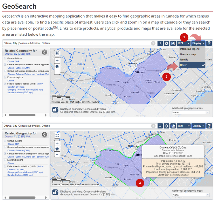
Display population and dwelling counts
GeoSearch allows you to find geographic areas in Canada for which census data are available. The interactive mapping application can either display the data by identifying on the map the census data of the selected geography or by using the hover tool when exploring the map.
The "Identifier" option is selected by default in the application.
To identify available census data:
- Click on the "Display" drop-down button.
- Click on "Identify."
- Click on the geographic area of interest.

To use the hover tool:
- Click on the "Display" drop-down button.
- Click on "Hover."
- Hover over the geographic area of interest.
- Date modified: