
Select a geography
Geographies in GeoSearch may be selected in one of two ways: by Place name/postal code or using the map.
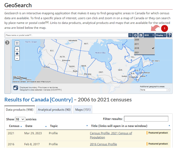
Prior to selecting a geography, several options and preferences need to be set. First, you must choose a data vintage of interest. Available vintages of data are based on Census of population years. The default vintage is always the most current. To work with a different vintage of data:
-
Select the year of interest in the "Vintage options" drop-down button.
Select a geography by Place name/postal code
Please see Options and preferences tutorial for more information on how to configure your search results.
Here are the steps to select a geography by Place name/postal code:
-
In the search bar, type the first few characters of a place name, a unique identifier (UID) or a postal code.
When searching by postal code, the selected geography is the most populated Dissemination area (DA) or Census subdivision (CSD) associated to the given postal code. On the map, there will be a representative pin ( ) displayed in the centre of the selected DA or CSD.
 - Select from the matching geographies that appear below as you type.
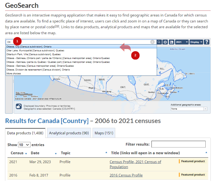
The application zooms automatically to the selected geography and highlights it on the map.
All sections will be refreshed and display information based on the selected geography.

Select a geography using the map
The interactive map can be used to select a geography:
-
In the map, use the plus and minus signs to zoom to the desired geography level to select from, OR pan (click and drag) in the map to get to the geography to select in the current active geographic level.
The active geographic level, from where geographies can be selected on the map, is displayed next to the "lock" icon below the map. Zooming in or out will change the active geographic level.

- Select the geography by clicking directly on an area on the map.
All the other sections will be refreshed and show information based on the selected geography.

- Date modified: